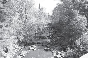
The Minnesota Pollution Control Agency’s (MPCA) recently released report on the Lake Superior—North watershed confirms it contains some of the least-polluted water bodies in the state. However, land use practices, increasing development, and a changing climate may pose threats to these high quality resources. In the near future, MPCA, partner agencies, and stakeholders will work together to develop protection and restoration strategies for these important aquatic resources.
Developed areas include the communities of Finland, Schroeder, Tofte, Lutsen, Grand Marais, Hovland, and Grand Portage. Significant development is also located along Lake Superior’s shoreline.
Continued development pressures will add to the pollutant problems of some streams. The lower reaches of the Poplar River and Flute Reed River are two examples of stream areas experiencing recent and continued significant growth in the watershed area near the stream shoreline.
A few streams that were monitored from 2001 to 2006 continue to be monitored today. The MPCA’s intensive watershed monitoring effort began in 2013 and is completed. Following monitoring, a watershed restoration, and protection study and an implementation plan will be developed.
A report is completed for one stream, the Poplar River. The study and an implementation plan are finished. The University of Minnesota conducted an investigation into sediment sources. For more information, visit the Poplar River TMDL Project webpage.
A citizens’ organization, in collaboration with the MPCA and the county Soil and Water Conservation District, have been monitoring the Flute Reed River.
Lake associations have been monitoring individual lakes and expanding management efforts to develop lake management plans. Three sentinel lakes, Tait, Greenwood, and Trout, are located in the basin.
Land use in the Lake Superior North watershed is a mix of smaller towns and commercial, resort and rural residential. Significant development is also located along Lake Superior’s shoreline. Tourism and forest products are significant components of land use activity. Some commercial/industrial uses, such as marinas, shipping ports and taconite processing support, depend upon water resources.
Several state parks are within the watershed, including Temperance, Cascade, and Judge C.R. Magney. A large section of the southernmost Boundary Waters Canoe Area Wilderness is also within the watershed.
Streams and rivers flow slowly through forested upland areas before plunging over steep rapids and waterfalls near Lake Superior. These high-quality water bodies support sensitive aquatic species and provide clean water for recreation and other uses. The watershed’s lakes also exhibit excellent water quality, and are enjoyed by many for fishing, boating, and other forms of aquatic recreation.
Geography and ownership shape the watershed’s development potential. More than 80 percent of its U.S. portion is under federal, state, county, or municipal administration. In general, development levels are low and mostly concentrated along the Lake Superior shoreline. However, development has increased in some areas, particularly along certain lakeshores, and may be negatively affecting water quality.
Land managers, community leaders and other stakeholders should consider the best available information regarding potential stressors when developing protection and restoration strategies. Protection strategies would help support the watershed’s exceptional fish and bug communities, swimming beaches, boating and other water-contact activities. These strategies may also help prevent future impairments.
Beginning in 2013, MPCA scientists and local partners began monitoring 135 lakes, 67 streams, and 27 Lake Superior beaches. Resulting water chemistry and biological data were used to determine whether these water bodies support aquatic life and recreational uses.
To view the Lake Superior – North’s monitoring and assessment report, visit https://www.pca.state.mn.us/water/watersheds/lake-superior-north.
The report’s highlights include:
. High water clarity and low levels of algae indicate 94 lakes support aquatic recreation and none of the assessed lakes were impaired for this use.
. Ninety-nine lakes have fish with high levels of mercury, which is the watershed’s dominant fish tissue contaminant. Fish consumption advisories are recommended for lakes across the watershed.
. Water chemistry and the amounts and types of fish and bugs found in 63 streams indicate full support of aquatic life.
. Three streams were impaired for aquatic life due to high levels of suspended sediment. Restoration efforts are under way to address these impairments.
. Low levels of bacteria in 18 streams and 27 Lake Superior beaches indicate that these beaches support aquatic recreation.


Loading Comments