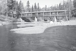
When it rains, dirt runs into the Poplar River. So much dirt in recent years that it has interfered with the life cycle of the trout. How do you calculate how much dirt is too much and where it is coming from? And how do you stop the dirt from washing into the river?
A low-tech problem is getting a lot of high-tech attention these days, and describing his tricks of the trade to the Poplar River Management Board (PRMB) at Caribou Highlands on December 6, 2010 was University of Minnesota Professor John Nieber, Ph.D. He is using computer models to assess exactly where the sediment in the Poplar River is coming from so that it can be stopped.
Lots of factors are involved in the problem—the grade of the hills surrounding the river, the type of vegetation on them, where roads, buildings and ski hills channel water when rain falls and snow melts, even how hard and fast the rain falls.
Nieber’s study, still in the works, piggybacks on a couple of other less detailed studies that have been conducted to address the sediment in the Poplar River. The findings will be used by the Minnesota Pollution Control Agency (MPCA) as it revises its standard for safe levels of sediment in trout streams. Every three years it reviews its various standards, some that address sediment, others that address things such as dissolved oxygen, copper, nitrates, ammonia, bacteria, PCBs, DDT, and mercury.
The MPCA doesn’t know at this point how much sediment is natural for the Poplar River. Old-timers know that the river mouths along the North Shore of Lake Superior are brown after every hard rain. The MPCA wants to know how much sediment is coming from roads, ditches, ravines, slumps, and gullies—or even from water carrying sediment underneath the ground. Knowing this will help them figure out what can really be done and will help determine where government dollars will be spent on mitigation.
“It’s a tough task,” said Minnesota Soil and Water Conservation District engineer Keith Anderson. “It’s a difficult task you’ve got here.”
Upcoming grant projects
ThePRMB is interested in Nieber’s findings because it is committed to targeting the biggest remaining causes of the sediment in a mitigation project that has been funded from a grant of $687,034 from the Environmental Protection Agency’s Great Lakes Restoration Initiative. A previous grant eliminated a lot of the sediment by altering the river’s flow and impacting an adjacent hillside known as the Megaslump.
ThePRMB will be waiting for more specific data from Nieber that will be used to design what is being called the Ullr Tightline Project, planned for next summer. A pipeline will be run down Ullr, part of the Lutsen Mountains ski area, leading to a rightangle turn in a concrete vault that will dissipate the force of the water and strain out the sediment.
Keeping the sediment cleaned out will be the responsibility of the property owner, Lutsen Mountains. Co-owner Tom Rider said that right now, a similar tightline, the Brule, is maintained every year. They get two “enthusiastic” young employees in waders who go out and “bucket out” the sediment that has collected.
Other projects will include mitigation around Caribou Highlands and along roads and ditches.
MPCA standards
TheMPCA is looking at a standard that will take samples throughout the year and assess them for the amount of solids suspended in them. The average of the year’s samples would need to fall under the standard, and any single sample of the water could not exceed the standard by more than 10%.
PRMB engineer Curtis Sparks plans to challenge the MPCA to test the water enough times each year so that random samplings after rainfalls wouldn’t skew the results so much that the average amount would exceed the standard.
Sparks said he is also appealing to the MPCA to acknowledge in its standard the vast difference in characteristics between northern Minnesota trout streams and southern Minnesota trout streams, which now have the same set of standards. Under Minnesota Statute, a Statement of Need and Reasonableness will need to accompany the revised standards.
Greg Johnson of the MPCA said the MPCA is considering setting different standards for non-trout streams in three eco-regions: north, central, and south. The Red River and the Minnesota River will have their own sets of standards.
Karen Evens of the MPCA reported on a conference at which the U.S. Forest Service reported on its work to maintain safe passages for fish. In an effort to promote the importance of streams, Evens said, the Forest Service would like to change perceptions so that people would see a road crossing over a stream rather than seeing a stream crossing under a road.


Loading Comments