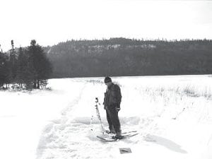
In August 2009, Cook County Land Commissioner Mary Black informed Cook County commissioners that the US Forest Service was accepting comments on a proposed reroute of a 2½-mile snowmobile trail between McFarland and South Fowl Lakes in Hovland. The intent of that comment period was to gather “information and issues” regarding how the sound from the proposed snowmobile route would affect the Boundary Waters Canoe Area Wilderness (BWCAW). Black said the public comments would be used, along with a sound analysis, to create a draft environmental impact statement (EIS), which would be available in April 2010.
The EIS took four months longer. Letters went out on August 9, 2010 to “stakeholders,” people or organizations who had commented in the past, informing them that the draft EIS was now available. Anyone who wishes to comment on the EIS must do so within 45 days from the date that notice of the EIS is published in the US Federal Register. According to Becky Bartol of the Superior National Forest, notice was published on August 13, starting the clock for comments to be completed.
It may take the entire comment period for interested parties to compile comments. Thedraft EIS is quite lengthy and is a combination of previous environmental analysis and the new information on the sound analysis that was conducted by the Forest Service. There are pages, maps, and charts describing the “zone of audibility” and dozens of pages explaining the methodology of the sound tests conducted. There are several chapters detailing the history of the closure of a trail determined to be in the BWCAW in 2002 and what has transpired since that time.
The reroute has been the focus of public scrutiny since 2002. That is when the Forest Service first sought comments from the public on several alternative routes for the closed trail. In February 2006, the Forest Service issued a decision selecting a route described as Alternative 2. This 2½-mile route was endorsed by Cook County, the Conservationists with Common Sense of Ely, and the Arrowhead Coalition for Multiple Use. Also supporting this route was the Grand Portage Band of Lake Superior Chippewa and the State of Minnesota.
Plans to construct the trail were halted in August 2006 by a lawsuit filed by plaintiffs Sierra Club, North Star Chapter; Wilderness Watch; and Northeastern Minnesotans for Wilderness. The matter was debated in court until March 2009, when the US State Court of Appeals, 8th Circuit, ruled that the Forest Service could construct the trail because it was not leading to a BWCAW lake.
However, the Court of Appeals set in motion the 2009 and the eventual 2010 comment periods, directing the Forest Service to “prepare an Environmental Impact Statement assessing the sound impact of each of the proposed South Fowl Trail routes on the adjoining wilderness area…The Forest Service is enjoined from conducting any further activity on the proposed trail pending completion of the EIS [Environmental Impact Statement].”
The first step of the EIS was “scoping,” which was why there was a comment period last August. Those comments have been compiled in the draft EIS. Thepublic now has 45 days to comment. When the comment period ends, the Forest Service will complete the final EIS and Gunflint Ranger Dennis Neitzke will issue a decision. South Fowl Project Coordinator Peter Taylor said there is no prescribed timeframe for when the decision has to be completed, however, he said it is hoped that it will be available in January 2011.
After the decision is issued there is another 45-day period in which administrative appeals regarding the plan can be filed to the US Forest Service regional forester. If there are no appeals, the project can be implemented 50 days after the decision is announced.
Taylor noted that there could, however, be a legal challenge to the decision at that time. At this time, Taylor said he did not know when the project must be taken back to court for the judge’s review.
The draft EIS can be reviewed on the Superior National Forest website at www.fs.usda.gov/superior, under Land and Resources Planning, then Projects.
Comments should be sent to Dennis Neitzke, Gunflint District Ranger, Attn: South Fowl Snowmobile Access Project, 2020 W. Highway 61, Grand Marais MN 55604. Comments may also be e-mailed to commentseastern superior-gunflint@fs.fed.us or faxed to (218) 387-3246.
The proposed snowmobile trail begins at the existing Little John Lake parking lot, crosses the Border Route Hiking Trail, and the now-closed Tilbury Trail snowmobile trail and moves southeast, ascending to a ridge above the Royal River. On the ridge the trail is approximately 400 feet from the wilderness, above the BWCAW. The route then follows the ridge away from the BWCAW in an east-southeast direction about 1.3 miles, then downslope northeast to level ground and directly east to South Fowl Lake. The proposed trail would replace one partially built by logger Verl Tilbury in the 1960s, before the creation of the BWCAW. The Tilbury Trail was not part of the groomed snowmobile trail system and was used primarily by Fowl Lake cabin owners and ice fishermen.


Loading Comments