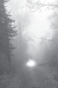
It may be a little easier for visitors to know where they can— and cannot—ride all-terrain vehicles in the Superior National Forest now that the U.S. Forest Service has implemented its Travel Management Plan. Maps showing forest roads open to ATVs are now available at the Gunflint and Tofte Ranger Stations. The plan does not construct any new trails, but clarifies which existing forest roads—like the one pictured above— are open to off-highway vehicles.

After more than six years of interagency collaboration, public involvement, and environmental analysis, Kristina Reichenbach of the Superior National Forest (SNF) announced on Wednesday, August 8 SNF is finally ready to implement the Travel Management Plan.
The Forest Service states that this will be of significant benefit to “natural resources on the Forest, to wilderness values, and to off-highway vehicle riders.” This project is part of the Forest Service-wide Travel Management Rule framework to address the growing number of outdoor enthusiasts who enjoy off-highway vehicle (OHV) riding in national forests across the country.
According to Reichenbach, the project redirects OHV use to “locations that increase safety and quality of experience for riders and reduce impacts to aquatic resources, wildlife, sensitive areas, and to the Boundary Waters Canoe Area Wilderness.”
This Travel Management Plan applies to all classes of motor vehicles except aircraft, watercraft, and over-snow vehicles.
To implement the Travel Management Plan, the Forest Service was required to develop Motor Vehicle Use Maps (MVUM) that will be updated annually. The maps, a series of four two-sided fold-up paper maps, will be available at all Superior National Forest offices. The maps will also be posted in a downloadable format on the Superior National Forest website. To view or download the Motor Vehicle Use Maps go to: www.fs.usda.gov/superior, select Recreation Opportunities then Off-highway Vehicle Riding and Camping.
As of August 8, 2012, motorized travel on the Superior National Forest is only allowed on roads and trails designated on the map.
What does it mean for ATVers?
According to Reichenbach, it means virtually the same total miles (1,600) of off-highway vehicle riding opportunities across the Superior National Forest will exist as before but redirected to locations that increase off-highway vehicle designated loop riding opportunities by 285 miles and long-distance riding opportunities by more than 300 miles.
What does it mean for water resources?
Reichenbach said water quality impacts will be reduced with reduced OHV use within riparian areas by 60 percent; reduced stream crossings open to any OHV use by 62 percent, and generally reduced OHV disturbance in streams. OHV use on trails and roads on soils more susceptible to disturbance and erosion will be reduced by 72 percent.
What does it mean for wilderness and other sensitive areas?
Reichenbach said there is a Forest-wide reduction of 154 miles of “unneeded roads” including a total of 9.5 miles currently within one mile of the BWCAW. OHV travel in sensitive areas, including inventoried roadless areas, RARE II areas, Research Natural Areas, candidate Research Natural Areas, and eligible Scenic and Recreational Rivers will also be reduced.
The Forest Service will be working with Tribal, state, and local agencies and with private organizations to provide information and education to off-highway vehicle riders regarding this new policy. Forest managers are also increasing road signing to help riders navigate with the new maps.
Cross-country travel by OHVs will continue to be prohibited on the Superior National Forest as directed in the Forest Plan.


Loading Comments