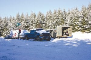
The US Forest Service is once again accepting comments on a proposed reroute of a 2 ½-mile snowmobile trail between McFarland and South Fowl Lakes in Hovland. The reroute has been the focus of public scrutiny since the Forest Service closed a trail that had been determined to be partially in the Boundary Waters Canoe Area Wilderness (BWCAW) in 2002. This round of public comment centers on how sound from the proposed snowmobile trail affects the BWCAW.
The first public comments were accepted by the Forest Service shortly after it developed several alternative routes for the trail. In February 2006, the Forest Service issued a decision selecting a route described as Alternative 2. Plans to construct the trail were halted in August 2006 by a lawsuit filed by plaintiffs Sierra Club, North Star Chapter; Wilderness Watch; and Northeastern Minnesotans for Wilderness. Among other complaints, the plaintiffs alleged that the proposed snowmobile trail brought snowmobiles onto a wilderness lake, arguing that North and South Fowl Lakes were actually in the BWCAW.
Joining the lawsuit in support of the US Forest Service plan to construct the Hovland snowmobile trail reroute was Cook County, Conservationists with Common Sense of Ely, and the Arrowhead Coalition for Multiple Use. Also supporting the Forest Service in the lawsuit was the Grand Portage Band of Lake Superior Chippewa and the State of Minnesota. Both entities filed Amicus, or Friend of the Court, briefs.
In March 2009, the US State Court of Appeals, 8th Circuit, issued a decision stating that because the Forest Service’s determination of the boundaries of the BWCAW and its treatment of the Fowl Lakes had been public knowledge for 30 years, the plaintiff’s failure to bring suit in a timely manner meant that the court must dismiss the claim that North and South Fowl Lakes are within the BWCAW. The higher court upheld the decision of Judge John R. Tunheim who first heard arguments in the case in December 2006.
However, the Court of Appeals set in motion the current comment period, by directing the Forest Service to “prepare an Environmental Impact Statement assessing the sound impact of each of the proposed South Fowl Trail routes on the adjoining wilderness area…The Forest Service is enjoined from conducting any further activity on the proposed trail pending completion of the EIS [Environmental Impact Statement].”
The first step of the EIS, according to Gunflint District Ranger Dennis Neitzke, is “scoping.” The Forest Service is seeking new information or issues regarding the impact of sound on the BWCAW. Comments will be accepted during the scoping period until September 24, 2009. Comments should be sent to Dennis Neitzke, Gunflint District Ranger, Attn: South Fowl Snowmobile Access Project, 2020 W. Highway 61, Grand Marais MN 55604. Comments may also be e-mailed to comments-eastern superior-gunflint@fs.fed.us or faxed to (218) 387-3246.
Following the scoping period, the Forest Service will complete a draft EIS and will offer another comment period. Presenting the information to the Cook County Commissioners on Tuesday, August 25, Land Commissioner Mary Black said it is estimated that the EIS will be completed in April 2010.
The proposed snowmobile trail begins at the existing Little John Lake parking lot, crosses the Border Route Hiking Trail and the former snowmobile trail and moves southeast, ascending to a ridge above the Royal River. On the ridge the trail is approximately 400 feet from the wilderness, overlooking the BWCAW. The route then follows the ridge away from the BWCAW in an east-southeast direction about 1.3 miles, then down-slope northeast to level ground and directly east to South Fowl Lake. The proposed trail would replace one partially built by logger Verl Tilbury in the 1960s, before the creation of the BWCAW. The trail, called the Tilbury Trail, was not part of the groomed snowmobile trail system and was used primarily by Fowl Lake cabin owners and ice fishermen.


Loading Comments